 Photo: Jan Suchánek · Unsplash
Pacific Coast Highway in five days, San Francisco to LA
Highway 1 north to south in five days. Monterey, Big Sur, Hearst Castle and Malibu, with the fees, the fuel and how to check the road is open.
National Geographic put the Pacific Coast Highway on its Best of the World 2027 list on 20 Oct 2026, one of 25 places and the only one in California. Its case starts with the road itself: after a landslide cut Highway 1 near Big Sur for almost two years, it was open end to end again. Drive it from San Francisco to Los Angeles, north to south, so the ocean is on your side of the car and every pullout is a right turn. Five days is the right length. Three is a windscreen tour.
One thing to know before you plan. This road closes, sometimes with a day’s notice, and it did so again the week this guide was written. The section on Big Sur below says exactly what we found and when.
Prices in this guide are US dollars and were checked on 21 Nov 2026.
Why north to south, and how the five days fall
Southbound puts you in the lane beside the water. The viewpoints are on your right, you don’t cross traffic to reach them, and the passenger gets the view instead of a rock wall. National Geographic gives the same advice.
The days fall like this. Day 1 is San Francisco to Monterey by the coast, about three hours of driving. Day 2 stays put for the aquarium, 17-Mile Drive and Carmel. Day 3 is Big Sur to Cambria, about 100 miles that take most of a day. Day 4 is Hearst Castle, Morro Bay and San Luis Obispo, ending in Santa Barbara. Day 5 is Malibu and Santa Monica. Sleep two nights in Monterey or Pacific Grove, one in Cambria, one in Santa Barbara.
One-way car hire is the cost people forget. Drop fees between San Francisco and Los Angeles vary by company and by week, and some firms advertise none on this route, so compare the full total for a one-way booking, not the daily rate.
Day 1: Half Moon Bay, Pescadero and Santa Cruz
Leave the city by Highway 1 through Pacifica, not the freeway. Half Moon Bay is about 45 minutes south and a good first coffee. Past it the road empties out into farm fields and bluffs, with Pescadero a short detour inland.
Pigeon Point Lighthouse stands right on the highway south of Pescadero. The 115-foot tower has been closed for restoration since 2001 and is due to reopen in spring 2027, according to National Geographic, which is one reason the road made its list. You can walk the grounds now.
North of Santa Cruz, Caltrans is running one-way traffic control at Waddell Bluff on weekdays from 07:00 to 16:00 until the end of 2026, with delays of up to 10 minutes. Santa Cruz itself is worth lunch and an hour on the wharf or the boardwalk before the last 45 miles round the bay to Monterey.
Day 2: Monterey, 17-Mile Drive and Carmel
The Monterey Bay Aquarium is the morning. Adults are $65, ages 5 to 17 and seniors over 70 are $50, and under-fives are free. The aquarium asks you to buy tickets ahead for a smooth entry, and on a weekend or in school holidays you should. Its new children’s exhibit, Ocean in Motion, has a living coral reef and a bigger penguin habitat.
17-Mile Drive is the private road through Pebble Beach between Pacific Grove and Carmel. The gate fee is $12.25 a car, refunded if you spend $35 or more at one of the Pebble Beach Resorts restaurants, and motorcycles aren’t allowed. It’s open sunrise to sunset. Take it slowly in the afternoon and come out at the Carmel gate.
Carmel is a village of cottages and a white beach at the bottom of Ocean Avenue. Have dinner here, and fill the tank before you go to bed.
I’d give Monterey the two nights and not try to squeeze Big Sur into the same day as the aquarium. Tell me your dates and I’ll set the days out so the aquarium ticket, the Hearst Castle tour and the long drive each get their own morning. I can’t see live road closures, so I’ll leave you a note to check Caltrans before the Big Sur day.
Day 3: Big Sur, the day the trip is for
From Carmel to Cambria is about 100 miles. Driven straight it takes two and a half to three hours. With stops it’s the whole day, and it should be.
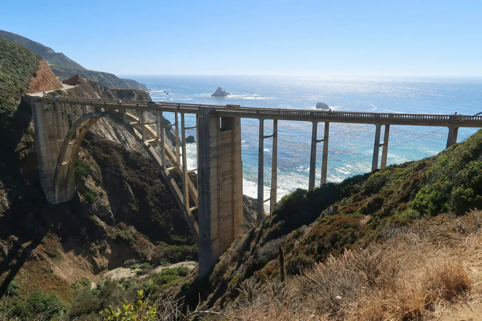
Bixby Creek Bridge comes about 13 miles south of Carmel. The pullout is on the north side, it’s small, and by late morning cars queue on the shoulder, so make it your first stop. Pfeiffer Beach is next, down Sycamore Canyon Road, a single lane 2.2 miles long with no RVs or trailers. The Forest Service car park holds 65 vehicles, costs $15, doesn’t take national park passes, and is usually full on summer and holiday weekends. When it’s full, staff turn cars away at the top of the road.
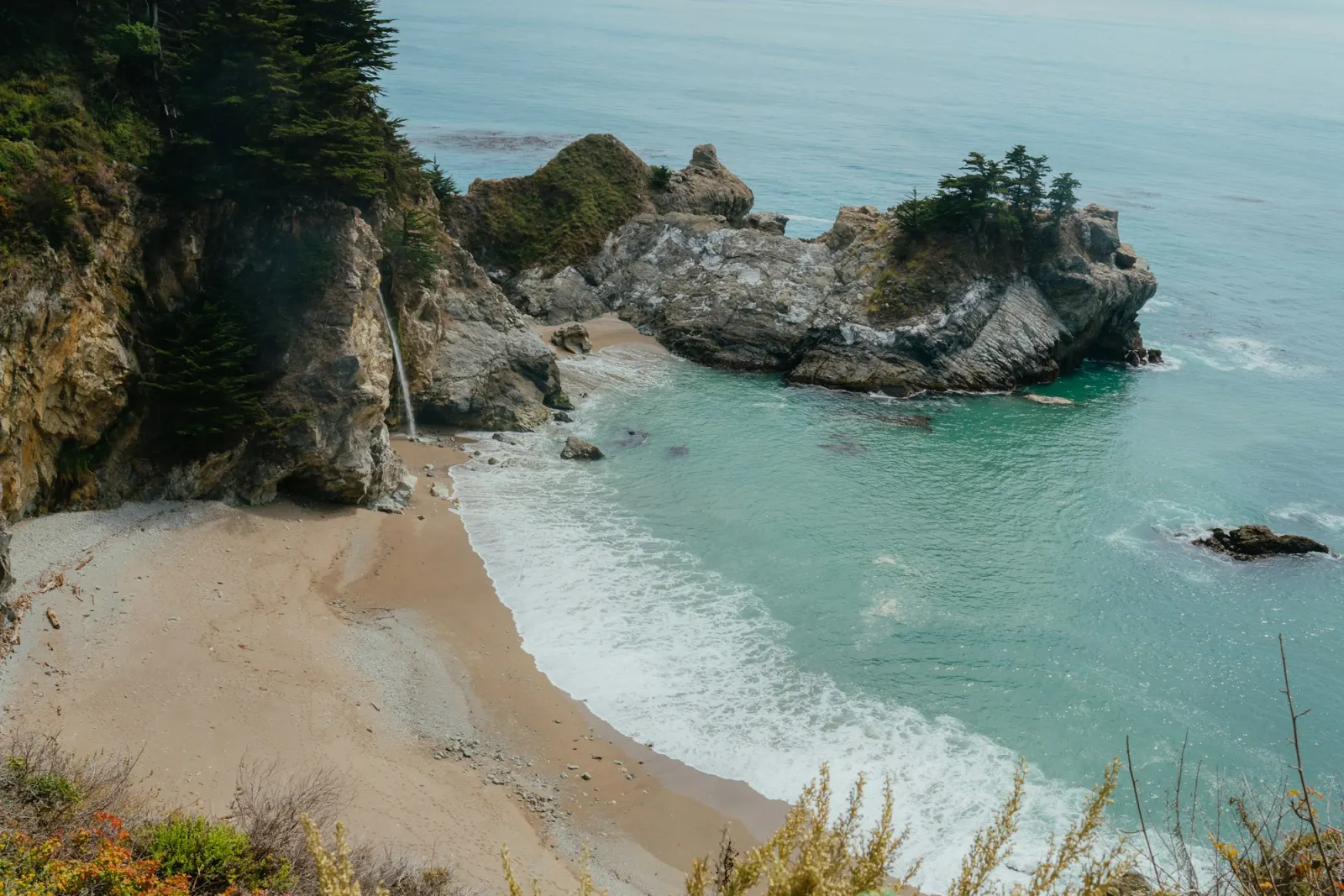
Pfeiffer Big Sur State Park is the redwoods and the river, $10 a car for day use, open 08:00 to sunset. It reopened on 16 Oct 2026 after the Timber Fire, with several trails still shut, the Pfeiffer Falls and Valley View trails among them. Julia Pfeiffer Burns State Park, further south, is where McWay Falls drops onto the beach. Day use is also $10. You look down on the cove from above, and there is no access to the beach or the water.
A day-use receipt from one California state park is widely said to get you into others on the same day. We couldn’t confirm that on a public State Parks page, so keep the receipt on the dashboard and ask at the first kiosk.
Check the road, leave early for Bixby, do the beach before the car park fills, and reach the seals in the last good light.
Two practical things about this stretch. Fuel is scarce and dear: the station at Gorda made the news through 2026 for charging $9.99 a gallon for premium, and people buy just enough there to reach the next town. And phone signal is patchy to absent for most of the coast between Carmel and San Simeon, so download the map for offline use while you still have hotel wifi.
Whether Highway 1 through Big Sur is open
Here is what we found on 21 Nov 2026. The road is open end to end, with delays.
The long closure at Regent’s Slide, which shut the highway in February 2024, ended on 14 Jan 2026. Then the Timber and Plaskett fires closed up to 40 miles of it in August. On Wednesday 18 Nov, ahead of a storm, Caltrans closed 46 miles from Nepenthe to Ragged Point because of the risk of debris flows off the burn scars. The storm did send mud, rocks and trees across the road. Caltrans shortened the closure to about 20 miles on the Thursday and reopened the highway on the morning of Friday 20 Nov.
Caltrans’ road conditions page, last updated at 12:40 on 20 Nov when we read it, lists one-way traffic control around the clock between Fernwood and Regent’s Point for emergency work, and local reports put the wait at about 10 minutes. It also lists one-way control at Rocky Creek Bridge until 30 Nov and at points between Point Sur and Big Sur until 31 Dec. The state park pages were still showing storm closures on 20 Nov, so check those separately.
Look at Caltrans QuickMap or the District 5 news page on the morning of the drive, not the night before. A fresh burn scar means Caltrans will close this road ahead of any heavy rain this winter, and it reopens only after crews inspect it. If it’s shut in the middle, drive down as far as you’re allowed, turn round, and take US 101 through Salinas to Paso Robles and Highway 46 to Cambria. There is no road across the mountains in between that you’d want to rely on.
Winter is when this happens, because winter is when it rains. Summer has the opposite problem: May and June are the foggy months, the “June gloom” that can hide the coast for hours. National Geographic’s pick is spring or autumn, and late August to early October for the clearest beach weather.
Day 4: seals, Hearst Castle and the Central Coast
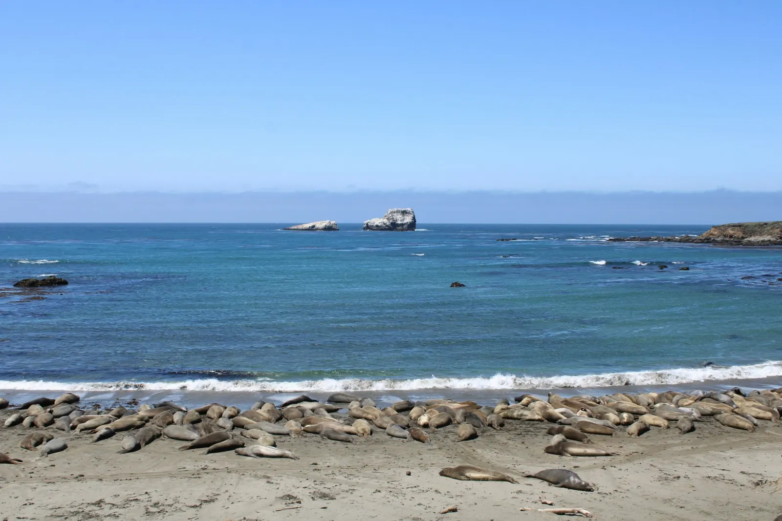
The elephant seal rookery at Piedras Blancas is seven miles north of San Simeon, right beside the highway, free, and open every day. The big season is December to March, when the bulls fight and more than 5,000 pups are born between mid-December and early February. October brings a second peak as the juveniles come ashore. If you ran out of light yesterday, start here.
Hearst Castle is William Randolph Hearst’s hilltop house above San Simeon, reached only by tour bus from the visitor centre. The Grand Rooms tour is $35 for adults and $18 for children aged 5 to 12, which includes a $5.50 booking fee. Reserve on ReserveCalifornia up to 60 days ahead, and arrive 20 minutes before your slot. Most days the first tours leave at 09:00. The castle is closed on Thanksgiving, Christmas Day and New Year’s Day.
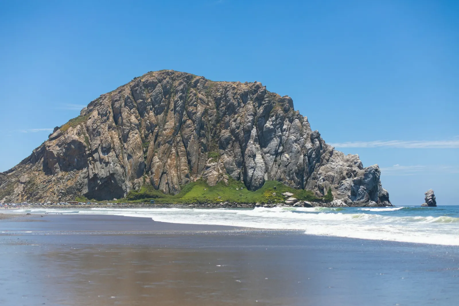
Cambria, a few miles south, is the natural place to have slept. From there the road leaves the cliffs. Morro Bay has the rock and a working harbour, San Luis Obispo is a good lunch, and then it’s US 101 and Highway 1 together down to Santa Barbara, about two hours on.
Day 5: Santa Barbara to Malibu and Santa Monica
Give Santa Barbara the morning: the Mission, State Street and Stearns Wharf are the easy three. Then follow the 101 to Oxnard and pick up Highway 1 again for the run past Point Mugu and Zuma into Malibu.
The Palisades fire of January 2025 closed this road for months. It reopened to everyone on 23 May 2025, and repairs are still going on. Caltrans’ project page, last updated in June 2026, shows a 25 mph work zone with single-lane closures between Carbon Beach Terrace in Malibu and Sunset Boulevard, 35 mph from Sunset to Temescal Canyon Road, and the normal 45 mph from there to Santa Monica. The state’s road conditions page listed no closures on Highway 1 in Los Angeles County on 20 Nov. Allow an extra half hour, and be patient through the burned stretch. People are rebuilding homes beside it.
The road ends, for this trip, where the McClure Tunnel swallows it at Santa Monica. Park, walk out along the pier, and you’re done. If you’re planning more of the year, our where to go in 2027 list has more ideas for the year, and the national park reservations guide (from 28 Nov) covers Yosemite if you’re adding it.
Trips others shared
Questions people ask
Is Highway 1 through Big Sur open?
On 21 Nov 2026, yes, end to end, with one-way traffic control near Fernwood and delays of about 10 minutes. It was fully closed from 18 to 20 Nov 2026 for storm debris off the Timber and Plaskett fire burn scars, and Caltrans will close it again ahead of heavy rain. Check Caltrans QuickMap on the morning you drive.
How many days do you need for the Pacific Coast Highway?
Five days from San Francisco to Los Angeles gives Monterey a full day, Big Sur a full day and time for Hearst Castle. Three days is possible only if you skip the aquarium and the castle and accept one very long day.
Which direction is best for driving Highway 1?
North to south. You’re in the lane beside the ocean, the viewpoints are on your right, and you don’t cross oncoming traffic to pull in.
What is the best time of year to drive the Pacific Coast Highway?
Spring and autumn. Winter storms can close the Big Sur section, and May and June are often foggy until the afternoon. Late August to early October has the clearest weather.
Do I need to book anything ahead?
Hearst Castle tours, up to 60 days out on ReserveCalifornia, and Monterey Bay Aquarium tickets for weekends and school holidays. The state parks and Pfeiffer Beach are first come, first served, so arrive early.
Five days down Highway 1, drafted in about a minute.
Lez takes this guide, your dates and how you like to travel, and gives the aquarium, Big Sur and Hearst Castle a morning each.
“Plan me 5 days driving the Pacific Coast Highway from San Francisco to Los Angeles, with Monterey, Big Sur, Hearst Castle and Santa Barbara”Ask Lez →